
This guide is based on a trip I made I made this trip 24th – 27th June (2025).
Rinjani is a semi-active volcano on the Island of Lombok. At 3,729m it’s the highest peak, and towers over the rest of the island on days when it is visible.
There’s a 2 day or a 3 day trek option. With Rinjani 2 day trek option, you spend one night on a lower ridge see the crater lake and the active volcano, then begin your descent back to Senaru in the morning.
With the 3 day trek, you see the crater lake, active volcano, walk down to the lake and hot springs. On the second night, you will walk and camp on a higher altitude ridge at 2,800m. At 2/3am on day 3, your guide will take you and a thousand other visitors up to the summit of Rinjani ,3927m, for Rinjani summit sunrise which is quite spectacular, if you make it up! Believe me, not everyone does.
I can’t think of any reason why you would do the 2 day trek. The 3 day is much harder, but it’s so much more rewarding. 2 days is like eating half an ice-cream then having it whipped out of your mouth as you’re about to take a mouthful.
The prices I’m giving here and all the experience are from the 3 day trek from SENARU. I booked it in Bang Sal, Lombok with my homestay owner.
If you want to, you can book online.
Rinjani trek price

I paid 2,678,000rp (including card fee). This was for the 3 day, 2 night trip going to the summit and crater lake from Senaru. I believe the opening price was above 3 million. Over the course of my travels, I bartered it down to this level. The company I booked with was called ‘Go Rinjani’. Go Rinjani is one of the main tour organisers for Rijani trips.
I didn’t book it directly with the tour company, I did it with one of my homestays. The owner gave me a better price than anyone else was offering.
The price in UK pounds was £127. That includes meals for the 3 days you will be hiking. Breakfast on day one to lunch on day three. You get a tour guide; he will speak English or other languages, (you must check), will talk to you about the hike and deal with any problems or questions. You get one night’s accommodation in a homestay in Senaru and two nights accommodation on the mountain. This is in two man tents. As I was a solo traveller, I got a tent to myself. You also get a sleeping bag. You may be able to hire essential kit, like boots or a jacket from your tour company. You should check with them if you require these items.
You don’t need to bring water or food. This is carried up for you by a group of 4-5 porters. You may need to bring snacks, like nuts or dried fruit. Biscuits or sweets.
Rinjani packing list
The main thing is change of clothes. And to keep them dry.
Rinjani is a mountain and the weather changes quickly. One minute it’s sunny, next the clouds are coming in and after that, you’re getting drenched in jungle style rain.
No matter what the season, you want to prepare for that eventuality by having a dry set of clothes to change into. The simplest way to keep them dry is by putting them in a large plastic bag within your day-sack.

Here’s a packing list from my experience of things which are essential for 3 day mount Rinjani trek.
- Small backpack or daypack (20–30 L):
When you go on the hike, they will only let you take a day sack with you. Your main baggage will stay back in the luggage room at your homestay. - Trekking shoes or sturdy hiking shoes:
Boots > trainers. The guides go up in flipflops. Not a problem. Come day 3 the flip flops disappear… One guy in our group tried in a pair of Vans. Didn’t make it. Another in walking sandals. Didn’t make it. If you want to think you’re gonna make it up in your flip flops or Vans or sandals or whatever, you’re in for an expensive and disappointing trip. - Warm clothing (jacket, beanie, gloves) for high altitudes:
(Although you can borrow or hire these from the guide company) It’s essential to pack a warm layer. Not necessarily waterproof. You can get a jacket from the tour company. You’ll at least one jumper or other warm layer over your t-shirt. I had a jumper, a T-shirt, a jacket AND a sleeping bag over me on night 2 and I was still cold! - Rain jacket or poncho.
You’ll need to bring your own. As waterproof as you can manage. When it does rain, it really rains. - Headlamp or flashlight:
Again, this is something that the tour company will be loaning you. If you have your own, bring that. - Sunglasses, hat, and sunscreen:
As you would on any prolonged period in the elements. - Towel and personal toiletries:
Only the minimum. You want to be at a sanitary level of cleanliness. Remember, it’s only 2 nights, any additional soaps or shampoos you won’t be using as there’s no opportunity to take a shower or wash. Wipes are going to be more useful. You don’t need to smell your best, everyone is in the same boat. - Extra snacks or energy bars:
As you go along. The meals are fairly substantial. I just got some biscuits and nuts to supplement. You can pick them up in the shops in SENARU before you leave. - Personal medication:
If you need it. Some plasters and mild anti-septic. Entirely up to you if you bring this. - Camera or smartphone:
They’ll be a thousand opportunities to take mind blowing pictures. The the phone reception does die off in certain areas. It’s never good on the mountain, but it’s certainly possible to connect and read messages if you have a local SIM card. E-sim won’t work at all. There are lot’s of people with expensive photography kit. When you get up there, you’ll see why. - Phone power bank:
If you’ve got a iPhone, the power bank is an essential piece of kit. My droid lasted the full 3 days but was entirely flat at the end. If you’re taking pictures with your phone or making content, this is essential. - Drone:
If you’ve got one, bring it. You won’t regret it. Some of the views and footage will be world class if you can work your drone. You’ll be allowed to fly your drone anywhere on mount Rinjani, there are no restrictions. - Walking sticks:
Mainly for day 3. This is something that your tour company will provide you at a cost. I did it without and it was EXTREMELY difficult on day 3. Without walking boots, wearing trainers and without sticks, I would have failed to make the summit. I did wear boots. Sticks are not essential, but your level of fitness is going to need to be that much higher if you’re going to attempt without.
Rinjani difficulty
How difficult is it to climb Mount Rinjani? This will depend or your levels of fitness, body weight (BMI) and hiking experience.
It also depends on the prevailing weather conditions. These things will make your experience harder or easier.
As a hiker that’s travelled to places like Nepal and been on high altitude treks under adverse conditions, (ice, snow, wind). I would rate the Rijani 3 day 2 night trek as DIFFICULT. If the weather is badly against you, VERY DIFFICULT or possibly DANGEROUS. I’ve even heard of instances where people have had to summit alone, as their guide has refused to due to adverse conditions presenting a danger that they wouldn’t take the group through.
I would not attempt if you don’t have a good level of overall fitness. Being young helps. Over 40 and you’re going to need to be in good shape. Obese and overweight, this is not the hike for you.
Health Check: Park authorities require a health check of your blood pressure and heart rate at the homestay. This involves conducting a blood pressure test and pulse. Everyone has to do it.
Don’t worry too much about this as it’s part of the package.
Before they will let you into the park to start the trek, you must show them the results of this health-check which you will have on a little bit of paper.
As an experienced hiker, I’d say this is the most difficult hike I’ve done. Not the most dangerous. That was Thorong-la or Anapurna Base Camp in Nepal. Rinjani final day summit, is much harder, physically than any walking I did in Nepal. More technical and more difficult.
Rinjani Terrian
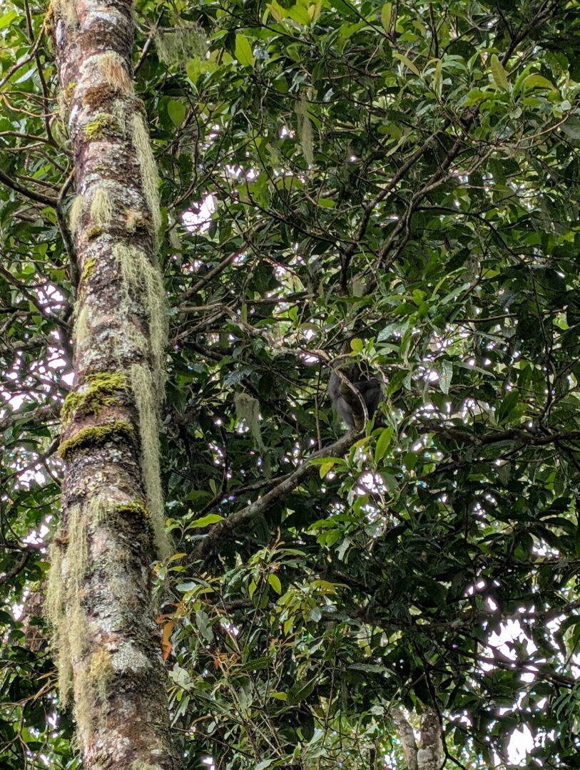
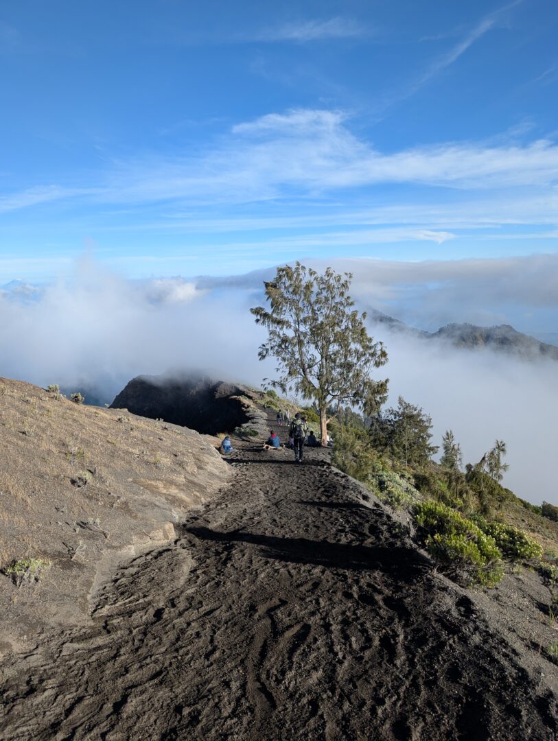
Day 1: You’re mostly in the jungle. Ascending through the foothills, usually covered by canopy. As they day goes on, you’ll emerge out onto the mountain side where there’s more grass and scrub and less tree cover.
By the first night, almost all of the tree cover will be gone and you’ll be on grassland.
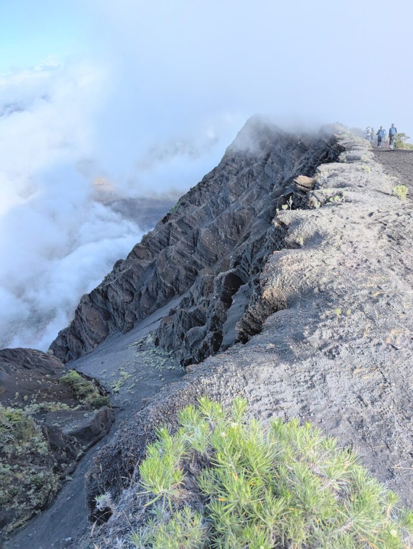
Day 2: Descending from a ridge into the crater lake. This is very pleasant walk. You’ll descend from the grassy plain onto the wooded sides of the crater by way of a steep stairway.
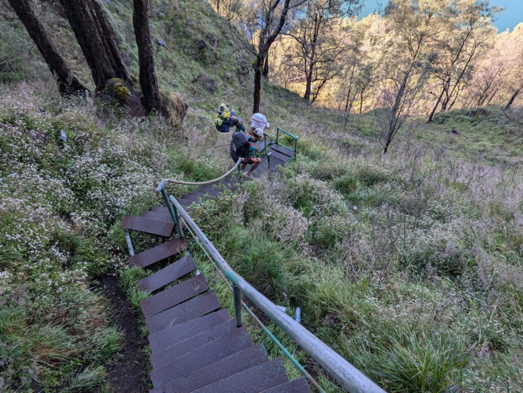
The stairway is partly constructed of steel banisters and wooden steps, nailed onto the mountainside. In parts, the banister has come away and has been replaced by rope sections. The park authorities have tried to make it so most of the most precarious parts have a banister or guard of some sort to protect you from falling. It’s certainly not always there, so you have to watch your step. It’s easy to fall and a long way down!
This climb down into the crater and active volcano area will take the majority of the morning on the second day.
You’ll have lunch on the lake’s edge in the crater.

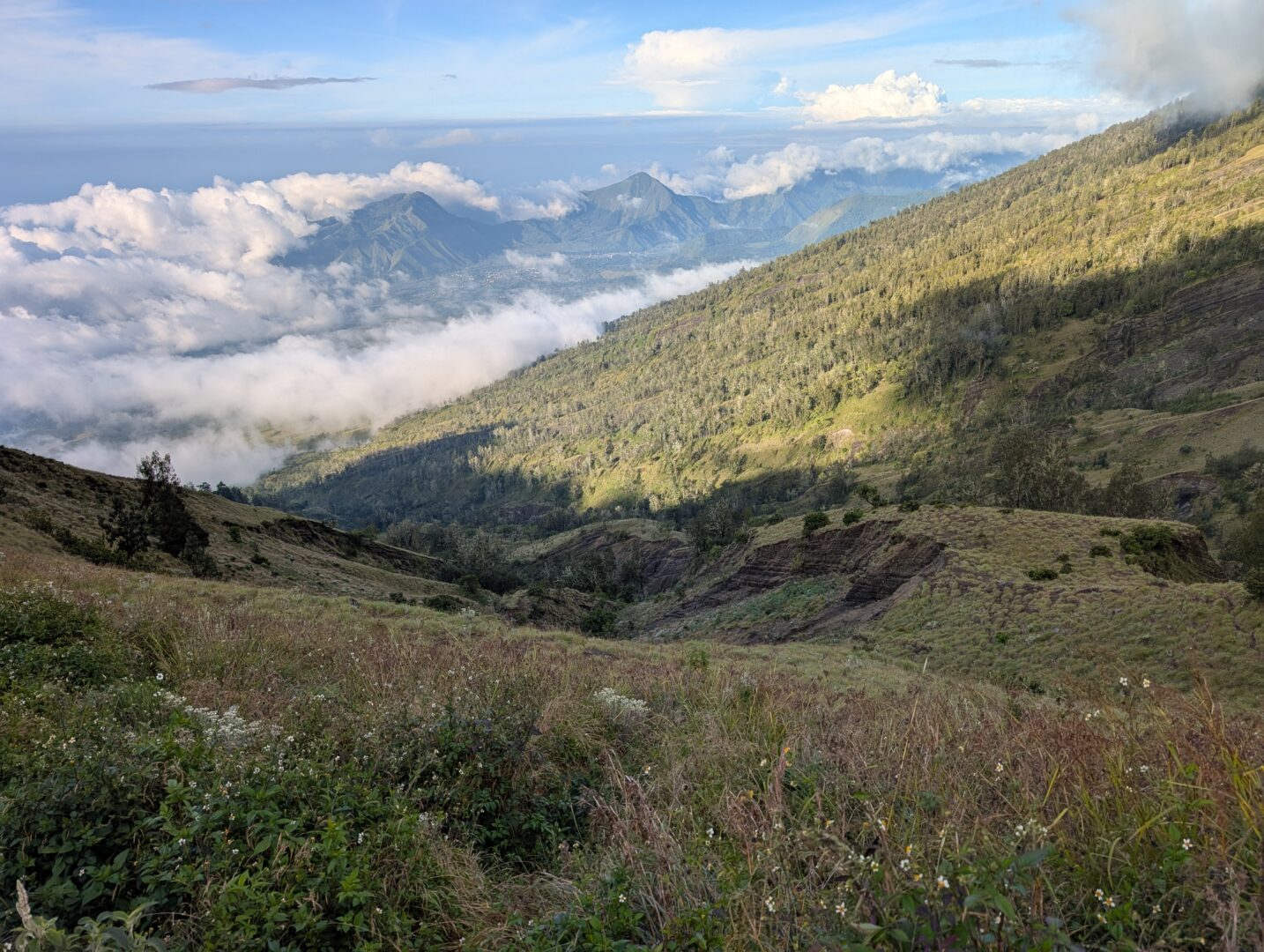
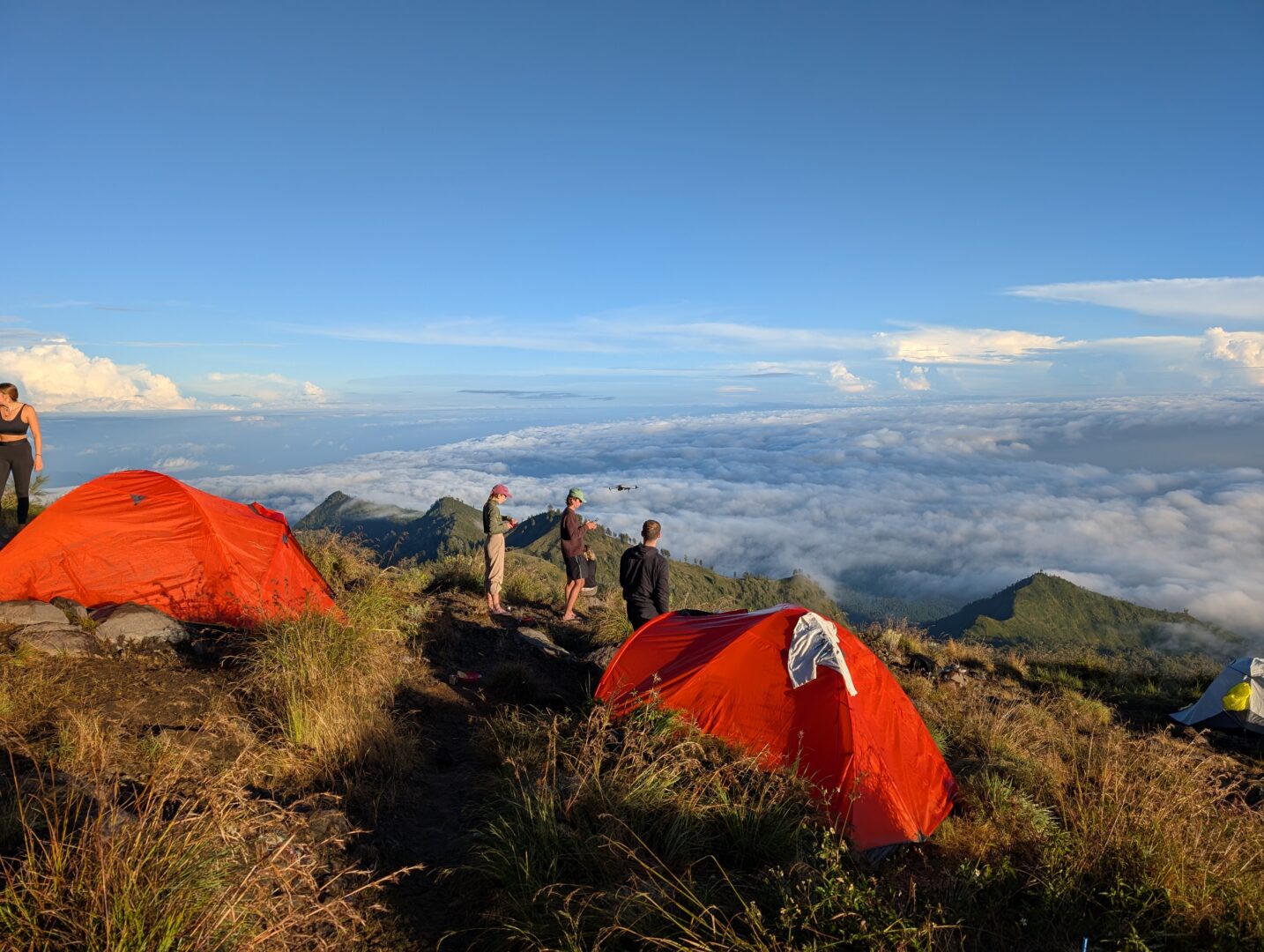
From the hot springs in the craters edge, you’ll ascend again, this time to a much higher ridge at around 2,800m. It’s rocky terrain right up until where you make camp for your final night.
The final day, you’ll be woken at around 2am. They’ll give you a very light breakfast and a cup of coffee. Then you’ll embark on:-
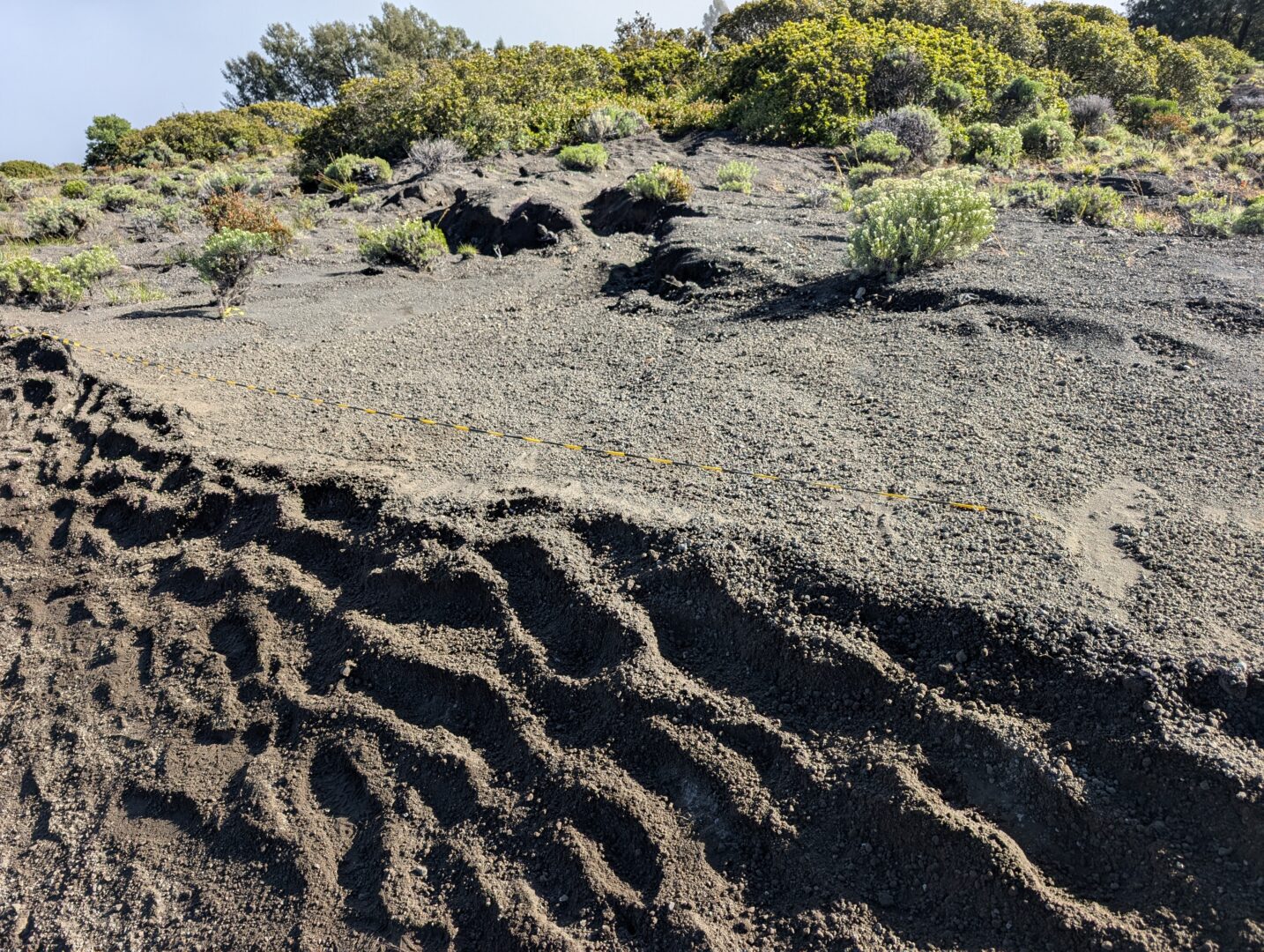
Day 3: Climbing conditions on the final 3 miles or so are atrocious. A mixture of sand, rocks and gravel. In parts it makes the climb similar to walking in snow in terms of consistency. This is with good prevailing weather conditions. With bad weather conditions, it may be worse.
The first maybe 3/4 mile is rocks and light sand. The incline is moderate.

You then pass along a ridge with a sharp drop on one side. This is where the Brazilian tourist Juliana Marins fell and lost her life, although not immediately. I’ve done a separate page here what really happened to Juliana Marins on mount Rinjani?
For the last 2 miles or so, what’s below your feet will be gravel. Some rocky outcrops, but 90% gravel. The incline steepens and the going is HARD. People fall over regularly.
The gravel is always shifting under your feet making it impossible to take a footing firmly without the assistance of poles.

If you, like I did, climb without poles, you’ll find this extremely tiring. Without either boots or a pole, ie. just in trainers, you will not be able to make summit. I had to turn my feet sideways on this gravel. With the boots, it was possible. Without the ankle support and protection, you may cause yourself some serious injury. Whatever kit you bring, it’s going to be hard work!
After making summit, you’ll go back to base camp, have a full breakfast, a rest, then get going for Sembalun. This is a long trek, maybe 15km or so? It’s reasonable, not difficult going, all downhill, pleasant countryside.
Quite enjoyable. Took us maybe 7 hours including a stop for lunch.
Rinjani Weather
This is a biggie. I’d rank weather conditions for climbing Rinjani in the following order from ideal to adverse:
- Cloudy overcast: Ideal. Won’t be overheating. No sunburn. Less stopping. Less tiredness. Only downside is it’s obscuring your views.
- Sunny: More stopping for drinks. More strain under the hot sun. Possible burn or strokes without the right preparation. Upside is better views.
- Raining: Will keep you cool during the day. Maybe too cool at night… Some of the terrain will be slippy. If you make camp and can’t dry any of your clothes, that can be dangerous. It’s not warm at night on the mountain. A lot of the time it rains in showers. Be prepared for rain, it happens a lot.
- Wind and rain: This is not ideal. If the wind and rain occurs on day 3, your guide may refuse to summit. In the event this happens, you can go it alone. You won’t be alone on the climb. It will be very difficult and possibly dangerous.
https://www.mountain-forecast.com/peaks/Mount-Rinjani/forecasts/3726 – To plan when to make the trek
https://www.google.com/search?q=mount+rinjani+weather – To get weather conditions whilst you make the climb, (you’ll need an Indonesian SIM), google search was providing me with the best results.
I found that the weather on a few apps were accurate. Most, like the Met Office, were not. Not even close to right.
There is actually a very small weather station close to the crater. It is possible to get accurate weather for the mountain whilst on it. The second link will do that.
That’s my guide over. Now I’m going to talk about my personal trip.
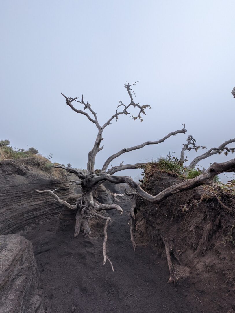
Here’s some photo’s I took whilst I was up there

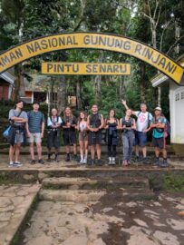
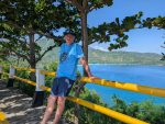
This is where we get taken by the truck up to the gates of Rinjani National Park. The truck’s pretty uncomfortable. When you reach the other side, Sembalun, the truck will take you back to Senaru which is about 30 minutes. This drive up to the entry gate only took about 7 minutes from our homestay in Senaru.
Our party was 9 people. The maximum party size, for our tour, is 10 people 1 guide.
Before they let you go into the park, you’re required to show your health certificate.

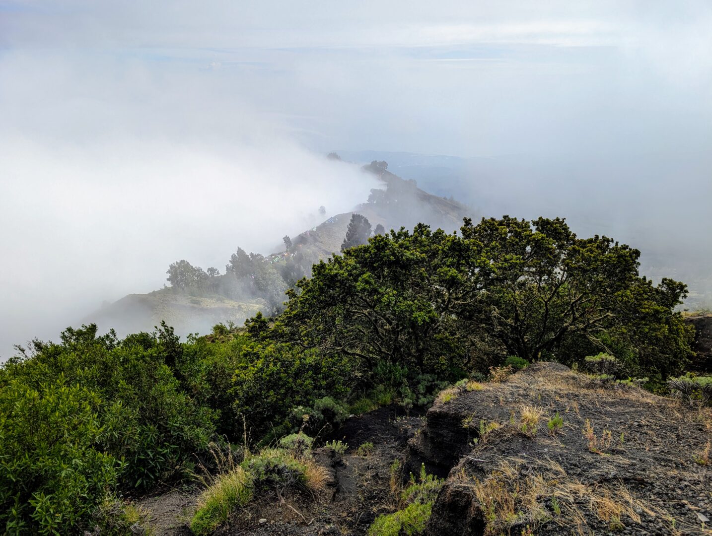
Day 2. The weather had cleared a lot overnight.
Watching the sun come up over the mountain was pretty awe inspiring.
We were cooked a breakfast and some coffee. Everyone had wet clothes from the day before when it rained from 2pm until about 5pm. We were all very wet when the day ended.
As the morning wore on, a lot of the focus was on people drying essential items of clothing that had got wet from the previous day. You can see a sample on the top of this tent.
One of the Dutch tourists had cracked his drone out and was flying it to get some aerial footage. We stopped here for a couple of hours after breakfast until everyone was happy. Compared to the first day, day 2 was a fairly simple hike.

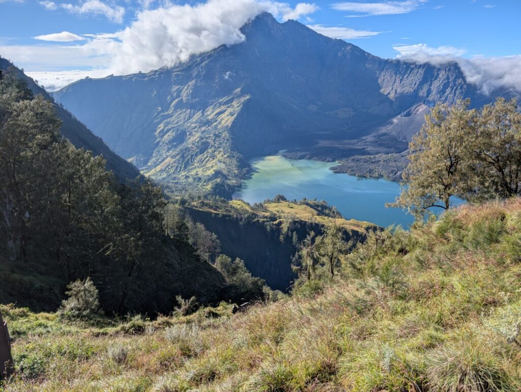
Descending into the crater area of the mountain.
It was wooded and crystal clear silent. Just the sound of the odd bird…
Magic.
You can imagine dinosaurs, or the odd pterodactyl winging it’s way around the un-spoilt wilderness.
I didn’t see any.
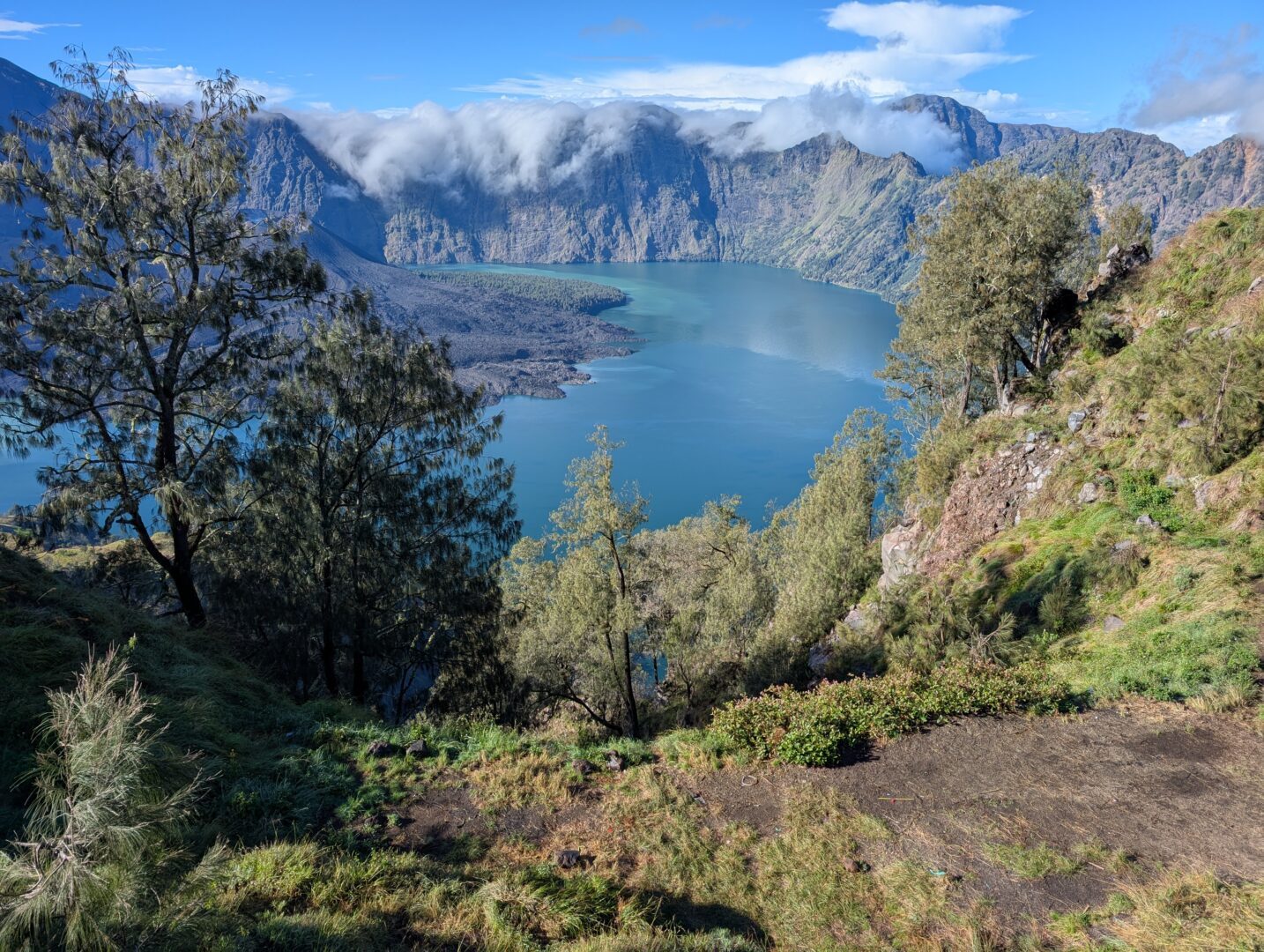
It took us the morning to climb down and the weather stayed good for the whole of our descent to the crater lake.

On the right of this photo, you can see the mount of the active volcano just above the tree. When the tourist Juliana Marins fell, it’s this volcano’s proximity to the summit that prevented them using it for the rescue. That and the weather conditions, which were not good on the days before we visited, which is when the accident happened.
As you can see, the volcano is some distance from the summit peak itself.

By lunch, we’d made it to the crater lake. It started to rain a bit as the cloud closed in. It was only a shower and overcast, nothing like the deluge we had experienced on day 1.
After lunch, we took a walk to the springs which are about 5 mins from the lake.
This was a really welcome respite for people’s tired feet! The water was hot, boiling in fact, in places. We stopped until people were rested, then moved off, up toward the higher ridge which would be our camp for the night.
When we’d pitched up for the night it was possible to see the lake from a different angle.

The climb up was fairly steep. There were a few stalls on the ridge selling refreshments like crisps and drinks. I didn’t need anything, so didn’t bother.
Slept well, up until the time when I was woken up. Not by the guide or members of our camp, but by the procession of hikers who were already up and making a steady stream of bodies progressing past the side of my tent.
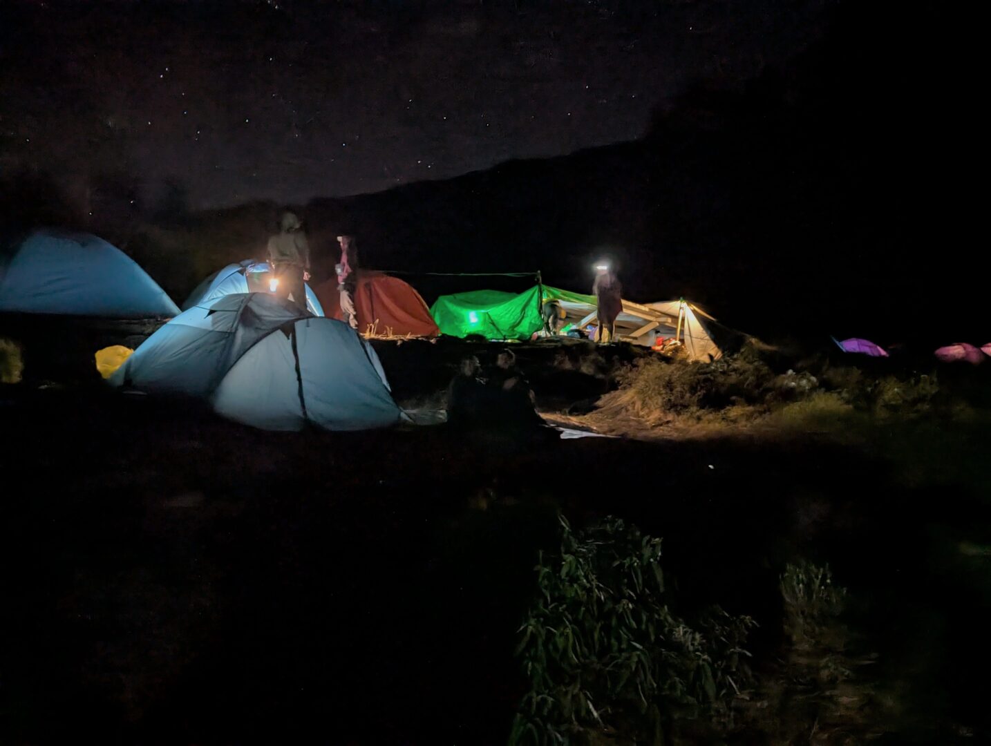
The others were not long to follow. After breakfast, we were given a briefing by the guide, who talked about what to expect from the climb. How long it would take. Terrain and the stages I talked about a bit before. He answered our questions.
Today we would be hiking without any daypacks. They would be remaining at the camp.
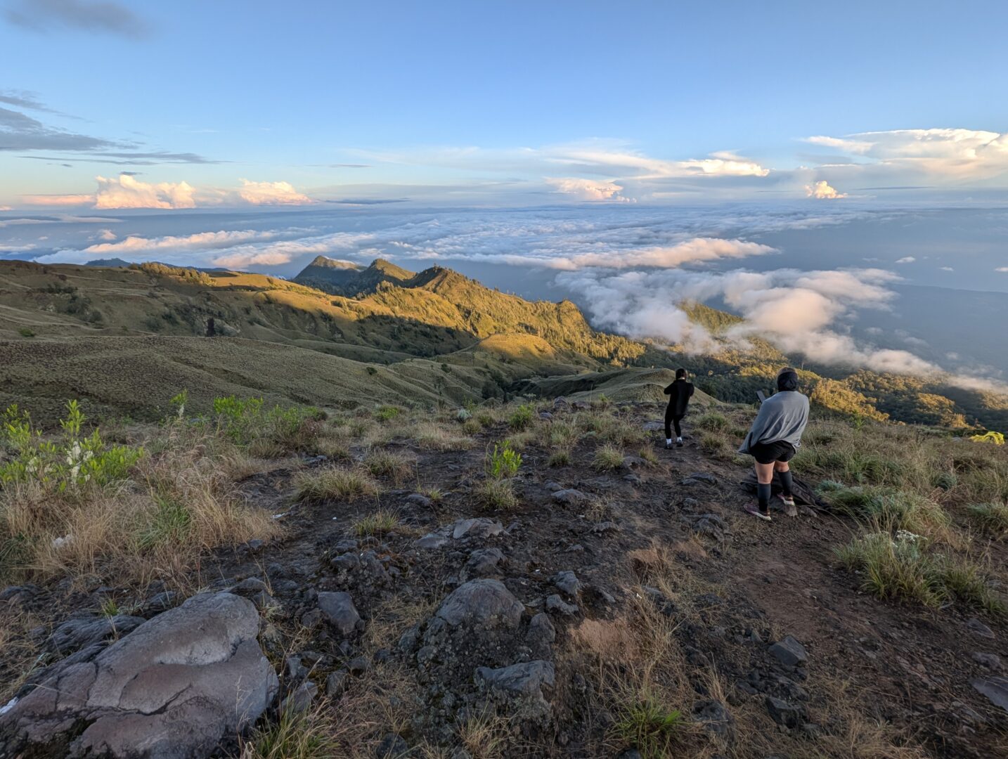
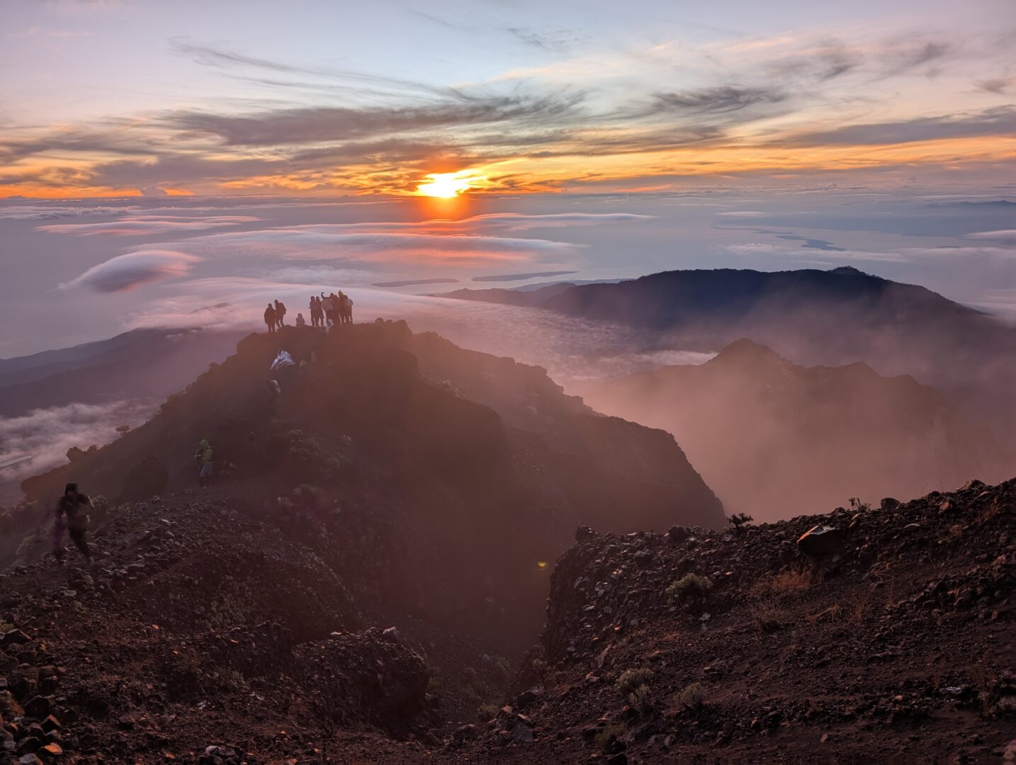
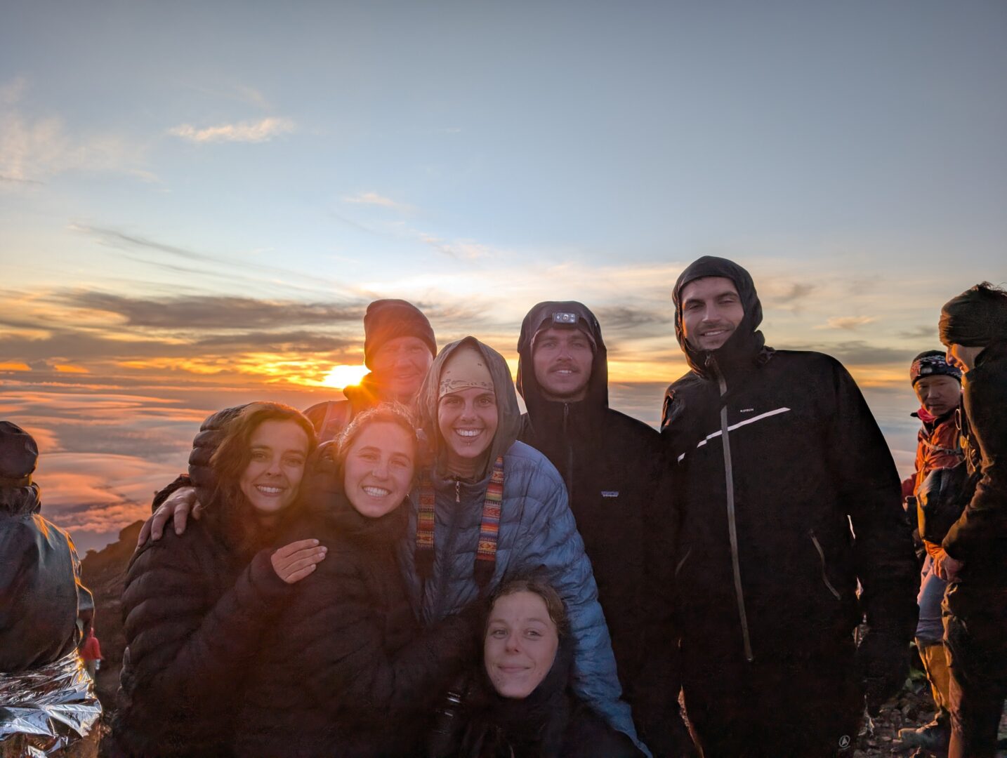
We would reach the summit to see sunrise over mount Rijani.
We actually got going at around 3am. We reached the summit at 6.25am. The sun rose at 6.28am.
It was a really tough climb, but to be at the summit as sunrise, it was worth it.

I was there about 5 minutes before. I only just made it. Others in the group had arrived earlier. It was without using sticks and that had an impact. Reaching summit before dawn was a close run thing.
There were plenty of people that didn’t make it, either for sunrise, or at all. 2 Korean members of our group didn’t make it up the last part, day 3. They had no sticks and the wrong footwear. One of the guy’s heals was red raw and needed bandages putting on it. He looked he was wincing with every step on the way down. Couldn’t have been nice.
A once in a lifetime experience.
The many tours that were there hung around for maybe 1/2 an hour. Not very long. Admired the view. Congratulated each other. Had a rest, then got going.
A full Breakfast was waiting for us at the bottom!

The descent is always much easier. In this case doubly so, as you’re not continuously fighting the gravel and scree shifting under your feet. There are great opportunities to fall over, and this happened to most people.

In the daylight, it’s slightly easier as you can get a view of the approaching hazards, also the different sights and landmarks which are truly remarkable in the light of day.
The tourist Juliana Marins fell first here into a plateau of gravel and scree 80m below. This gained a lot of media coverage as the Indonesian authorities weren’t prepared to close the park whilst they made the rescue attempt. Juliana had been climbing this section of the mountain 3 days prior to our visit. One of the guides showed us where exactly events took place. This was the first of two falls she experienced. The first one she survived. The second, she didn’t.

I talked to locals people involved in the rescue effort about Juliana Marins and what happened to her.
It’s unfortunate when someone comes to harm doing what they love. We should try to bring a level of responsibility when journeying in wild places.
Respect them.
We can lose our lives with little or no warning when we do stupid things or act without thinking.
We had our full breakfast at the ridge camp. Which you can see below.
The food was always really good throughout our hike. Cooked by a group of 5 porters who carried up the ingredients and would prepare a lunch breakfast and dinner for all of us.
The morning of day 3, we’d had just one pancake and a coffee for our 2am start. Everyone was hungry and this meal felt particularly good after having conquered the highest point on the island of Lombok and one of the most famous in Indonesia!
Not long after, we got going on our walk back down. This time, a different route to the village of Sambalun.
The going was much easier, a steady drift down. The sun was not too strong for the majority of it.
After lunch, the cloud cleared, it got much hotter and the sun was out in full force.
By the time we reached our transport in Sembalun, we were all hot and sweaty and desperate for cold drinks and the opportunity for a sit down.
It’s a 7 hour trek down from the summit and was the longest period of continuous walking on the whole trip.

So that’s it! My blog about my adventure on Mount Rinjani!
Wouldn’t have missed it for the world.
Undoubtedly one of two high points on my whole 6 week trip to Indonesia

If you like my guide or if you got any questions pls add a comment.
Related Reading

In the 1990’s, a political scientist named Stanley Feldman developed a set of four very simple questions to related to parenting to test the level...
My travel blog looking around Senggigi in the North of Lombok and the Eastern Gilli's.
I flew from Jakarta. It was the simplest option in terms of time and cost. The trains that run to the east of Java have...

Top 14 tips for Amazon Flex drivers (UK). Map of Amazon Flex depots. Amazon Flex contract for drivers.

60+ mysterious deaths of high powered bankers from 2008 - 2024
Wow what an wonderful adventure. That sunrise in that place…. spectacular, never to be forgotten experience.