
This post describes how to create Google Maps from a GPS devise.
Your Etrex will output two lots of data available from the GPX files.
The two types of data allow you to create.
A Google Map of Waypoints
A Google Map of Tracks
There is a process you need to follow:-
Plug in your GPS unit.
Access Ozi Explorer.
Use the interface to import your waypoints..
A Google Map of Waypoints
1) Ozi Explorer
Get Waypoints from GPSFile > Save Maps to File > Export to GPX – Save to Desktop
2) GPS Visualizer
You’ve got a selection of options.In order to get them into Google Maps, they have to be in a web accessible format. So choose Google Earth format.
Once your file is uploaded you should be given a link to download your file which looks something like this 1211203282-21568-82.37.19.123.kmz.
Click on it get it to your desktop.
3) Googlemaps
Go to Googlemaps.co.ukGo to My Maps
On Create New Map > Import > KML File
A Google Map of Tracks
… lifted straight from previous blogs on the subject.
1) Ozi Explorer
From the interface > Get track from GPSIf you’ve done it correctly, you’ll get a tally in the toolbar.
Wait until this has finished.
File > Save Maps to File > Export to GPX – Save to Desktop
2) GPS Visualizer
Again, you’ve got a selection, choose Google Earth and your file will convert to a web-ready format.From your link, 1211203282-21568-82.37.19.123.kmz, save to desktop.
3) Googlemaps
Go to Googlemaps.co.ukGo to My Maps
On Create New Map > Import > KML File.
If the file is a large one Maps will split it up over a number of pages.
That’s it! Google plots your waypoints/tracks then zooms to center the map.
It’s as simple as giving your waypoints/tracks some names and you can share this map with the world.
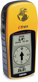
Hardware
Garmin Etrex GPS
Garmin PC interface cable (RS232 serial port connector) – not applicable to Geko 101![]()